"Chinese GPS" system (BeiDou) begins service
- Dec 28, 2011
- Article
- Space Operations

China announced on Dec. 27, 2011, that its Beidou-2 (also called "Compass") Navigation Satellite System has become fully operational, broadcasting timing and navigation services. The announcement means that China now has the ability to provide satellite navigation to its civilians and military without the need of the U.S. Global Positioning System (GPS). China has been launching Beidou satellites since Phase-I started testing in 2000 and has now officially started regional operations with 10 satellites (Beidou Phase-II) and publication of the Beidou Interface Control Document (ICD) available from www.beidou.gov.cn. Analysis performed with STK Software from AGI (AGI) shows that the operational Beidou satellites provide regular coverage over China and the hotly contested South China Sea, but they currently provide very little to no coverage elsewhere in the world.
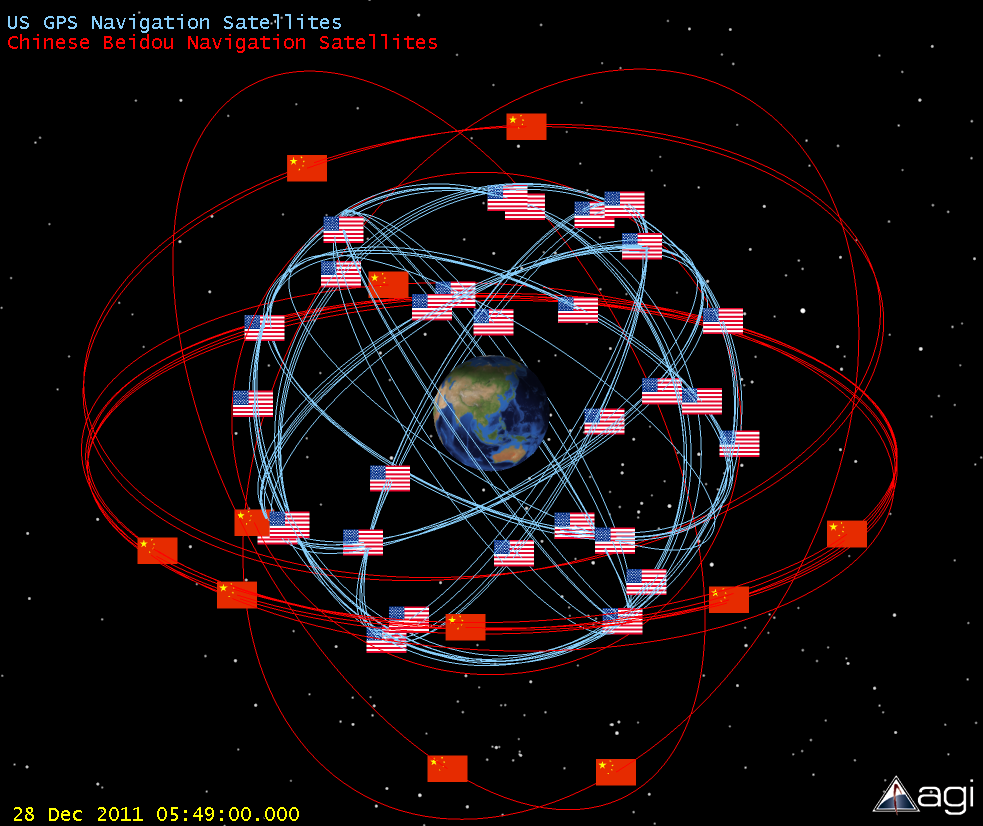
The U.S. GPS satellite constellation and Russian Glonass constellation are the only operational systems currently capable of providing navigation services globally, but China has plans to expand Beidou coverage globally (Beidou Phase-III) by 2020, the same year Europe plans to launch operations of its own global navigation satellite system called Galileo. To get a better understanding of the current Beidou system, see the video below that shows the Beidou and U.S. GPS orbits as well as the Beidou satellites’ coverage quality on the Earth surface. YouTube Video of STK Beidou Analysis
*Blog corrections to Beidou/Compass naming conventions made on January 2nd, 2012