Bird's-Eye View with EOIR
- Jun 28, 2021
- Blog Post
-
 Systems Tool Kit (STK)
It’s helpful to have different points of view when you're analyzing mission scenarios in STK. As most people know, STK has an overall mission view in its graphics windows — with depictions of access lines, orbit tracks, and other scenario elements. It also has a data-level view in the form of reports and graphs. The visuals provide a broad mission understanding while the numbers provide a focused one. But with STK EOIR, you can also gain a bird’s-eye view, which adds real-time, constraint-specific dimensions that are vital to mission analysis.
EOIR provides a realistic focus; one that is tighter than the full mission viewpoint in STK’s standard graphics windows but not as close as raw data. EOIR enables you to model remote sensing instruments. In addition to data providers, EOIR sensors also have a "synthetic scene" that enables you to generate an image of what the sensor would see given its definitional parameters, lighting conditions, and proximity to its target image. Since EOIR sensors are often attached to aircraft and spacecraft, this synthetic scene provides a bird’s-eye view of the mission. Below, you can see the raw, unprocessed image generated during sunlight from a sensor mounted on a geostationary satellite with a field of view that encapsulates the entire Earth.

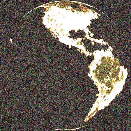
While this imagery is impressive, your mission scenario could include a series of smaller sensors and you might wonder how EOIR fits into this use case. You’ll be happy to know that it works just as well. Below, you can see a series of processed images stitched together from 16 sensors in a 4x4 arrangement to create the image above.
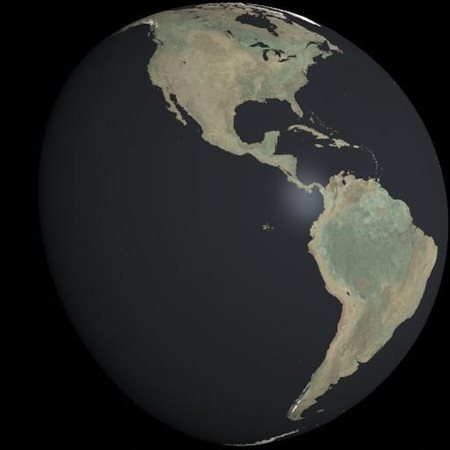
The image on the left represents the globe during sunlit times while the image on the right represents the globe in complete umbra. The lighting that you see in the umbra picture presents emissivity and reflectance environment variables mapped to those regions of Earth. In effect, I have mapped night light imagery to STK so that the umbra images consider the reality of artificial lighting on Earth.
You might be worried that working with something like 16 sensor objects would take a painful amount of time, but with this set of scripts located at the AGI Github, you can automate a variety of processes such as setting changes, exporting images, and stitching images together.